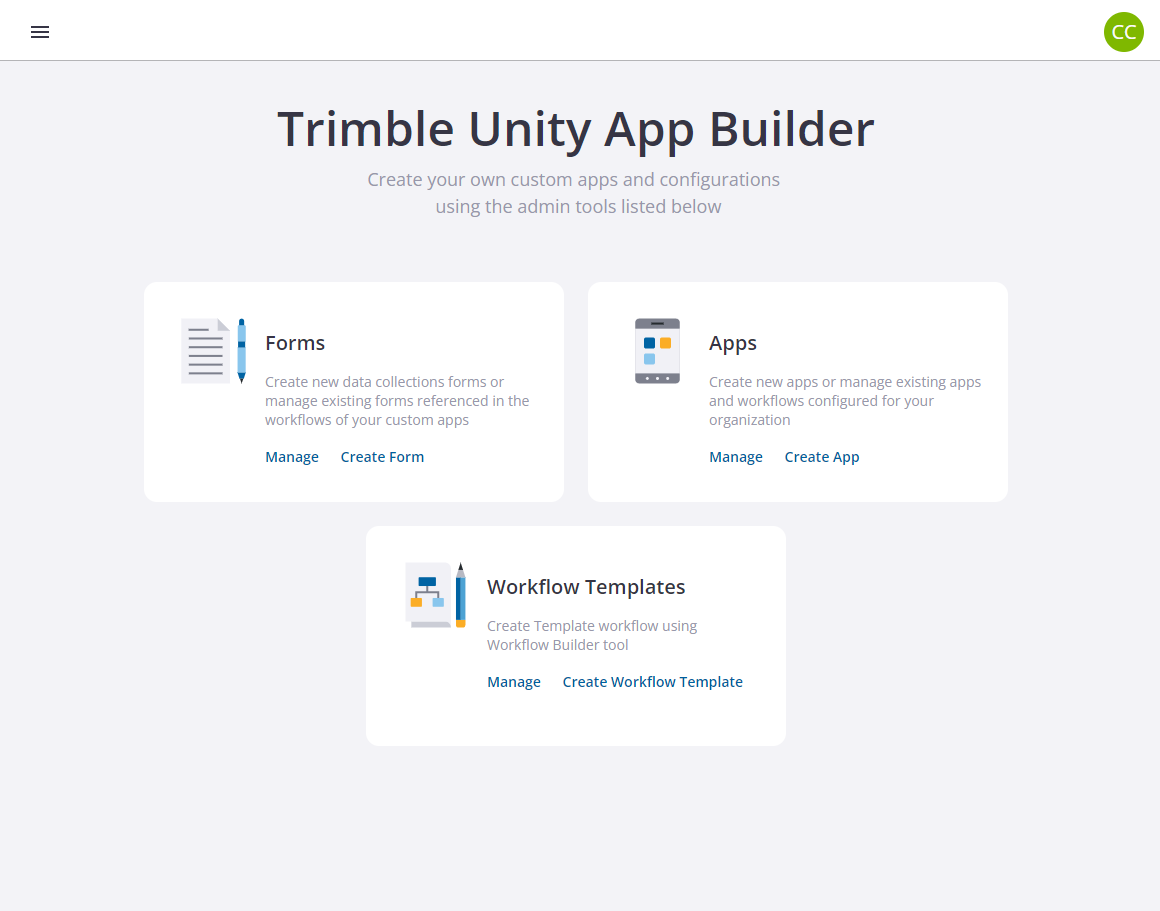
Create ArcGIS Feature Layer for Data Collection Forms

- From the Forms section, click Manage.
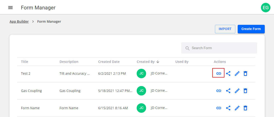
- Find the form you want to set up in ArcGIS, and select it from the list and then click the ArcGIS Connector Link option. Trimble Unity will show a toast message at the bottom of the screen confirming the ArcGIS URL is copied to the clipboard. Note that the URL copied for the selected form would look like the below example: https://ugs.dev.trimbleunity.com/unity/rest/services/F_f_7514c6c254244339a1e46d712792260f/FeatureServer
- Now log in to ArcGIS Online/Enterprise with a "Creator" user.
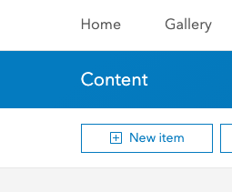
- Click New Item.
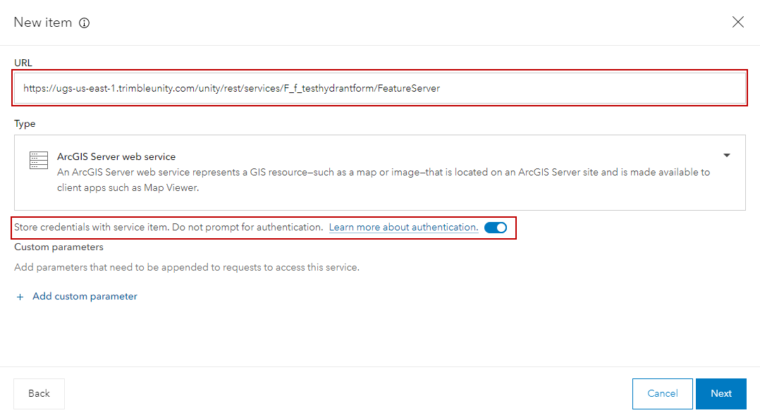
- Select URL from the list of options.

- Enter the form URL copied in step 4.
- Paste the URL from Trimble Unity.
 IMPORTANT: Be sure to enable Store credentials with service item. Do not prompt for authentication.
- Click Next.
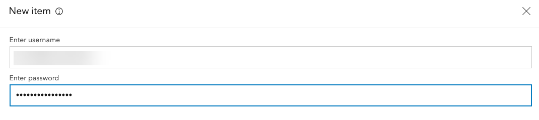
- Enter the Trimble Unity admin Username in the format of <username>@<orgname> and enter your Password. Use the admin account created in Create a Trimble Unity Admin User for the WM ArcGIS Connector.
- Enter any service details you want to include, then click Save.
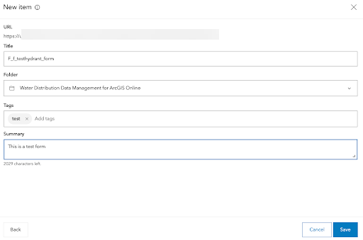
You are then redirected to the new content item details.
- Customize the item as needed.
- Click Open Map Viewer to view the data.
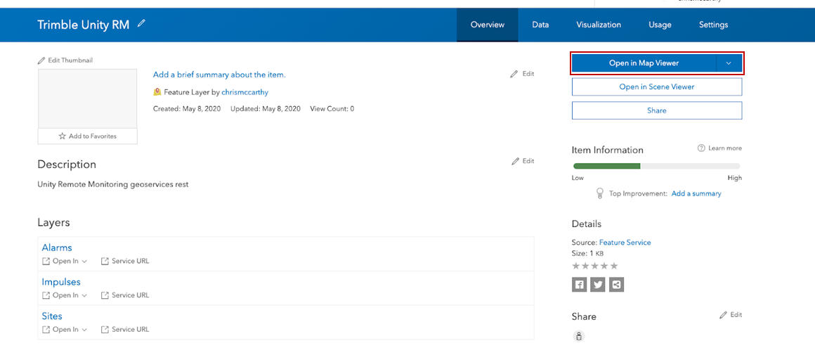
Now that the data is available in ArcGIS Online/Enterprise, you can create ArcGIS web maps and dashboards that combine data from Trimble Unity WM and GIS then shared across the organization. For more information on creating ArcGIS dashboards, see Esri's ArcGIS Dashboards documentation.