Configure GIS Updates for KPIs
The GIS can be updated by KPIs from Unity Remote Monitoring, with individual network layers (asset types) associated with specific KPIs.
|
|
 PREREQUISITES:
- Click the Remote Monitoring Configuration icon in the upper-right corner.

- Click Manage in the KPI Update Settings panel.
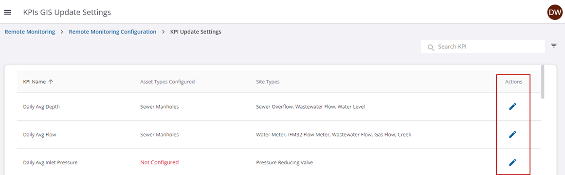
The available KPIs are shown. The Asset Types Configured column shows the GIS updates configured for that KPI. The Site Types column shows the site types associated to the KPI.
- Click the edit icon next to a KPI to configure its GIS updates.
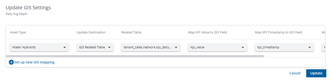
- Enter the information to associate that KPI to the GIS layer. You can configure a single KPI for multiple GIS layers.
- Asset Type: Select the layer that will be updated.
- Update Destination: Select GIS Feature to apply the KPI update to the feature, which will update the value on the feature on a daily basis. With this option, the KPI value is overwritten with the new value. Select GIS Related Table to apply the update to a related table, which will insert a record in the table with that day's value. With this option, you will have a history of the values that have been recorded.
- Related Table: If you selected GIS Related Table for the Update Destination, select the related table to update. This field is not available if GIS Feature is selected for the Update Destination.
- Map KPI Value to GIS Field: Select the GIS field where the KPI value will be saved.
- Map KPI Timestamp to GIS Field: Select the GIS field where the KPI timestamp will be saved.
- Map KPI Monitoring Site Name to GIS Field: Select the GIS field where the monitoring site name will be saved.
- Click Update.
You can add additional layers or modify a GIS update at any time by clicking the edit icon next to the KPI.